Von Jmages hochgeladene Dateien
Aus Radreise-Wiki
Diese Spezialseite listet alle hochgeladenen Dateien auf.
| Datum | Name | Vorschaubild | Größe | Beschreibung | Versionen |
|---|---|---|---|---|---|
| 11:09, 28. Feb. 2012 | Elbe (retour) s.png (Datei) | _s.png) |
664 Bytes | 2 | |
| 20:20, 20. Sep. 2011 | Gera (retour) s.png (Datei) | _s.png) |
666 Bytes | Wiki-Bot: Höhenprofil-Thumbnail | 1 |
| 17:36, 26. Dez. 2011 | Radweit Heidelberg - SAP - Friedrichstal - Karlsruhe (retour) s.png (Datei) | _s.png) |
666 Bytes | Wiki-Bot: Höhenprofil-Thumbnail | 1 |
| 17:36, 26. Dez. 2011 | Radweit Mannheim - Karlsruhe s.png (Datei) |  |
667 Bytes | Wiki-Bot: Höhenprofil-Thumbnail | 1 |
| 20:22, 20. Sep. 2011 | Oder-Neiße s.png (Datei) |  |
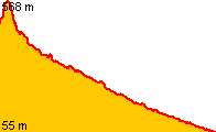
668 Bytes | Wiki-Bot: Höhenprofil-Thumbnail | 1 |
| 07:03, 22. Aug. 2013 | Nordseeküstenradweg Niederlande s.png (Datei) |  |
673 Bytes | 2 | |
| 20:20, 20. Sep. 2011 | Gera s.png (Datei) |  |
676 Bytes | Wiki-Bot: Höhenprofil-Thumbnail | 1 |
| 20:31, 20. Sep. 2011 | Ems s.png (Datei) |  |
677 Bytes | Wiki-Bot: Höhenprofil-Thumbnail | 1 |
| 20:27, 20. Sep. 2011 | Braunschweig - Wolfsburg s.png (Datei) |  |
678 Bytes | Wiki-Bot: Höhenprofil-Thumbnail | 1 |
| 21:18, 8. Feb. 2012 | Friesischer Heerweg s.png (Datei) |  |
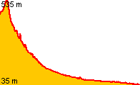
679 Bytes | == Beschreibung == Höhenprofil Vorschaubild == Lizenz == {{cc-by-sa}} | 1 |
| 20:23, 20. Sep. 2011 | Urdonautal s.png (Datei) |  |
681 Bytes | Wiki-Bot: Höhenprofil-Thumbnail | 1 |
| 07:48, 31. Jan. 2012 | Radweit Mainz - FfM Goetheturm - Hanau (retour) s.png (Datei) | _s.png) |
683 Bytes | == Beschreibung == Höhenprofil Vorschaubild == Lizenz == {{cc-by-sa}} | 1 |
| 21:16, 28. Dez. 2017 | LF 13 Schelde-Rijn-Route s.png (Datei) |  |
685 Bytes | == Beschreibung == Höhenprofil Vorschaubild == Lizenz == {{cc-by-sa}} | 1 |
| 20:19, 12. Mär. 2012 | Radweit Berlin - Hamburg s.png (Datei) |  |
686 Bytes | == Beschreibung == Höhenprofil Vorschaubild == Lizenz == {{cc-by-sa}} | 1 |
| 20:23, 20. Sep. 2011 | Treidelweg s.png (Datei) |  |
689 Bytes | Wiki-Bot: Höhenprofil-Thumbnail | 1 |
| 20:24, 20. Sep. 2011 | Gurkenradweg s.png (Datei) |  |
690 Bytes | Wiki-Bot: Höhenprofil-Thumbnail | 1 |
| 06:51, 29. Mai 2012 | Radweit Wiesbaden - Karlsruhe (retour) s.png (Datei) | _s.png) |
690 Bytes | == Beschreibung == Höhenprofil Vorschaubild == Lizenz == {{cc-by-sa}} | 1 |
| 17:36, 26. Dez. 2011 | Radweit Heidelberg - SAP - Friedrichstal - Karlsruhe s.png (Datei) |  |
695 Bytes | Wiki-Bot: Höhenprofil-Thumbnail | 1 |
| 06:51, 29. Mai 2012 | Radweit Wiesbaden - Karlsruhe s.png (Datei) |  |
695 Bytes | == Beschreibung == Höhenprofil Vorschaubild == Lizenz == {{cc-by-sa}} | 1 |
| 20:16, 20. Sep. 2011 | Rinteln - Minden s.png (Datei) |  |
697 Bytes | Wiki-Bot: Höhenprofil-Thumbnail | 1 |
| 07:48, 9. Jun. 2017 | Mosel (retour) s.png (Datei) | _s.png) |
700 Bytes | 2 | |
| 20:19, 12. Mär. 2012 | Radweit Berlin - Hamburg (retour) s.png (Datei) | _s.png) |
701 Bytes | == Beschreibung == Höhenprofil Vorschaubild == Lizenz == {{cc-by-sa}} | 1 |
| 20:27, 20. Sep. 2011 | Hornburg - Börßum.png (Datei) |  |
702 Bytes | Wiki-Bot: Höhenprofil | 1 |
| 19:46, 14. Okt. 2012 | Sauerlandradring Nordschleife s.png (Datei) |  |
704 Bytes | == Beschreibung == Höhenprofil Vorschaubild == Lizenz == {{cc-by-sa}} | 1 |
| 20:27, 20. Sep. 2011 | Frankfurt - Lorsch s.png (Datei) |  |
705 Bytes | Wiki-Bot: Höhenprofil-Thumbnail | 1 |
| 07:48, 31. Jan. 2012 | Radweit Mainz - FfM Goetheturm - Hanau s.png (Datei) |  |
707 Bytes | == Beschreibung == Höhenprofil Vorschaubild == Lizenz == {{cc-by-sa}} | 1 |
| 19:44, 11. Apr. 2014 | Schwülme s.png (Datei) |  |
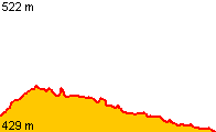
711 Bytes | == Beschreibung == Höhenprofil Vorschaubild == Lizenz == {{cc-by-sa}} | 1 |
| 20:37, 22. Mär. 2014 | Spree s.png (Datei) |  |
712 Bytes | 2 | |
| 20:19, 20. Sep. 2011 | Ahr s.png (Datei) |  |
713 Bytes | Wiki-Bot: Höhenprofil-Thumbnail | 1 |
| 20:28, 20. Sep. 2011 | Bernau - Niederfinow s.png (Datei) |  |
713 Bytes | Wiki-Bot: Höhenprofil-Thumbnail | 1 |
| 17:01, 9. Dez. 2023 | Brenz s.png (Datei) |  |
714 Bytes | == Beschreibung == Höhenprofil-Vorschaubild == Lizenz == {{cc-by-sa}} | 1 |
| 20:19, 20. Sep. 2011 | Aare s.png (Datei) |  |
715 Bytes | Wiki-Bot: Höhenprofil-Thumbnail | 1 |
| 20:26, 20. Sep. 2011 | Erft s.png (Datei) |  |
717 Bytes | Wiki-Bot: Höhenprofil-Thumbnail | 1 |
| 20:23, 20. Sep. 2011 | Ruhr s.png (Datei) |  |
717 Bytes | Wiki-Bot: Höhenprofil-Thumbnail | 1 |
| 10:24, 5. Okt. 2011 | Emmerich - Amsterdam s.png (Datei) |  |
719 Bytes | 2 | |
| 18:59, 31. Jan. 2012 | Emscher s.png (Datei) |  |
721 Bytes | 2 | |
| 08:25, 5. Jul. 2023 | Rhone s.png (Datei) |  |
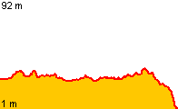
723 Bytes | 1 | |
| 06:34, 26. Aug. 2016 | Brettach (retour) s.png (Datei) | _s.png) |
724 Bytes | == Beschreibung == Höhenprofil Vorschaubild. == Lizenz == {{cc-by-sa}} | 1 |
| 20:26, 20. Sep. 2011 | Wörthersee-Radweg s.png (Datei) |  |
724 Bytes | Wiki-Bot: Höhenprofil-Thumbnail | 1 |
| 20:27, 20. Sep. 2011 | Frankfurt - Lorsch (retour) s.png (Datei) | _s.png) |
728 Bytes | Wiki-Bot: Höhenprofil-Thumbnail | 1 |
| 08:22, 12. Feb. 2012 | Radweit Sontheim - Memmingen - Dickenreishausen s.png (Datei) |  |
731 Bytes | == Beschreibung == Höhenprofil Vorschaubild == Lizenz == {{cc-by-sa}} | 1 |
| 20:29, 20. Sep. 2011 | Ulster (retour) s.png (Datei) | _s.png) |
731 Bytes | Wiki-Bot: Höhenprofil-Thumbnail | 1 |
| 17:36, 26. Dez. 2011 | Radweit Heidelberg - Walldorf - Graben - Karlsruhe (retour) s.png (Datei) | _s.png) |
732 Bytes | Wiki-Bot: Höhenprofil-Thumbnail | 1 |
| 18:56, 4. Feb. 2012 | Radweit Osnabrück - Paderborn s.png (Datei) |  |
732 Bytes | == Beschreibung == Höhenprofil Vorschaubild == Lizenz == {{cc-by-sa}} | 2 |
| 06:28, 11. Jul. 2012 | Myrdal - Flåm s.png (Datei) |  |
733 Bytes | == Beschreibung == Höhenprofil Vorschaubild == Lizenz == {{cc-by-sa}} | 1 |
| 20:29, 20. Sep. 2011 | Wern (retour) s.png (Datei) | _s.png) |
733 Bytes | Wiki-Bot: Höhenprofil-Thumbnail | 1 |
| 20:30, 20. Sep. 2011 | Osnabrück - Paderborn s.png (Datei) |  |
734 Bytes | Wiki-Bot: Höhenprofil-Thumbnail | 1 |
| 18:56, 4. Feb. 2012 | Radweit Osnabrück - Paderborn (retour) s.png (Datei) | _s.png) |
735 Bytes | == Beschreibung == Höhenprofil Vorschaubild == Lizenz == {{cc-by-sa}} | 2 |
| 11:06, 26. Aug. 2012 | Brettach s.png (Datei) |  |
737 Bytes | == Beschreibung == Höhenprofil Vorschaubild == Lizenz == {{cc-by-sa}} | 1 |
| 20:18, 20. Sep. 2011 | Hamburg - Bremen s.png (Datei) |  |
741 Bytes | Wiki-Bot: Höhenprofil-Thumbnail | 1 |